1874 rezultatov
-
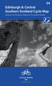 Edinburgh & Central Southern Scotland Cycle Map 24(2022) CYCLE MAPS UKThe next map in the Cycle Maps UK series covers the city of Edinburgh and the area to the south.10,55 €
 -
 Harrogate & Ilkley(2019) HANNON, PAULThis book provides 25 enjoyable outings amid a rich variety of scenery. A collection of 40 colour photographs depict features and landscapes along the routes, while the concise route descriptions are complemented by a wealth of background information.Vezava: Mehka10,68 €
 -
 Harrogate & Nidderdale(2019) HANNON, PAULThis new title is one of the first two in an updated series of Paul Hannon's `Short Scenic Walks' guidebooks. The principle feature is that all walks are less than five miles in length, offering a perfect half day's stroll for families, casual walkers andVezava: Mehka8,90 €
 -

-
 South West Coast Path Map Booklet - Vol 2: St Ives to Plymouth(2021) DILLON, PADDYMap of part of the southern section of the 630 mile (1014km) South West Coast Path National Trail. Covers the trail from St Ives to Plymouth along the west Cornwall and Devon coastline. This convenient and compact booklet of Ordnance Survey 1:25,000 mapsVezava: Mehka20,82 €
 -
 Iles Canaries - Zoom Map 125(2017) MICHELINMichelin's Zoom collection are characterized by the high precision of their detailed scale, specially adapted for very touristy areas or with a high density road network, including new developments and industrial areas. Scales from 1:53,000 to 1:1,267,2009,25 €
 -
 Fife Pocket Map(2021) COLLINS MAPSExplore new places with handy pocket maps from Collins. Handy little full colour map of the coastal Kingdom of Fife. Detailed mapping and tourist information from Dundee in the North to Edinburgh in the south and from Fife coast in the east to5,60 €
 -
 Skye Pocket Map(2022) COLLINS MAPSHandy little full colour Collins map of Skye with a high level of detail. Clear mapping of the Isle of Skye showing the road network, ferries and places of interest. Map at a scale of 1:175 000 (3 miles to 1 inch).5,60 €
 -
 -Z Master Atlas of Greater London(2022) A-Z MAPSThe ultimate street atlas to navigate your way around London. A comprehensive paperback street atlas of London encompassing an area of 1,450 square miles with coloured street mapping, and including more than 90,000 streets and otherVezava: Mehka34,92 €
 -
 Snowdonia(2016) MARSH, TERRYNew edition of the best-selling walking guide to Snowdonia featuring 28 circular, graded walks all tried and tested by seasoned walkers, featuring popular mountains in the Snowdon group, striking valleys, and beautiful lakes and forests in the region. AllVezava: Mehka18,21 €
 -
 South West England's Coast(2019) VICCARS, SUENew Pathfinder (R) walking guide to South West England featuring 30 circular walks ranging in length from 2 to 13 miles. Exploring the UK's most popular National Trail, the South West Coast Path, all walks are accompanied by GPS waypoints, Ordnance SurveyVezava: Mehka18,21 €
 -
 Snowdonia(2022)Each walk features a simple-to-follow route profile and accompanying description and pictures, and new-look walk mapping that makes it easier for the user to focus on the route and the points of interest along the way.9,80 €


