1874 rezultatov
-
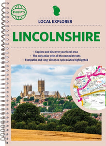
 Philip's Local Explorer Street Atlas Lincolnshire(2022) PHILIP'S MAPSPhilip's created this new series for walkers, cyclists and local explorers at a scale that provides greener options to uncover all the nature and hidden gems in your local area. From Boston to Stamford, we cover Lincolnshire in enticing detail.23,82 €
 -
 Philip's Local Explorer Street Atlas Somerset(2022) PHILIP'S MAPSPhilip's created this new series for walkers, cyclists and local explorers at a scale that provides greener options to uncover all the nature and hidden gems in your local area. From Bath to Yatton, we cover all of Somerset in glorious detail.23,82 €
 -
 SW Coast Path South Devon Adventure Atlas(2017)The A-Z Adventure series features the accuracy and quality of OS Explorer mapping in a convenient book, complete with index.Vezava: Mehka14,39 €
 -
 SW Coast Path Dorset Adventure Atlas(2017)The A-Z Adventure series features the accuracy and quality of OS Explorer mapping in a convenient book, complete with index.Vezava: Mehka16,62 €
 -
 SW Coast Path South Cornwall Adventure Atlas(2017)The A-Z Adventure series features the accuracy and quality of OS Explorer mapping in a convenient book, complete with index.Vezava: Mehka16,07 €
 -
 SW Coast Path North Cornwall Adventure Atlas(2017)The A-Z Adventure series features the accuracy and quality of OS Explorer mapping in a convenient book, complete with index.Vezava: Mehka14,89 €
 -
 National 3 Peaks Challenge Maps(2019) BRAWN, DAVIDNational 3 Peaks Challenge Maps. Ben Nevis, Scafell Pike and Snowdon at 20k scale. Waterproof, tearproof and 100% recyclable 820mm by 420mm double sided map sheet.12,61 €
 -
 Isle of Wight Walkers Map(2019) BRAWN, DAVIDIsle of Wight Walkers' Map at 32k scale with challenge routes and walking trails highlighted. OS 50k scale mapping is expanded in size to produce a 32k map. The OS features, text and logos are now 50% larger making them much easier to read under outdoor c16,81 €
 -
 Edale Skyline Challenge Map(2020) BRAWN, DAVIDEdale Skyline Challenge is the most scenic of challenge routes thanks to the ridge line nature of its route. At just over 20 miles with a 10 hour challenge time it is suitable for fit leisure walkers as a great day out in good weather; in bad weather it r9,80 €
 -
 Alpujarras Tour and Trail Map(2020) BRAWN, DAVIDFor the best adventures, use the best map. The Moorish white villages of the Alpujarras are well known to day trippers from the Costa del Sol. For walkers this is an idyllic region with stone-laid donkey trails linking the tipico villages and stretching u16,81 €
 -
 Surrey 3 Peaks Challenge Map and Guide(2022) BRAWN, DAVIDSurrey 3 Peaks Challenge Map and Guide is a 25k scale OSlike map with the Challenge route specially highlighted. With its easy access, and ten hours target time, the Surrey 3 Peaks Challenge can be completed in a single (long) day if you are within commut12,61 €
 -
 Lake District North(2021)New Superwalker XT25 of the Lake District. Revised and re-designed It's got everything! Genuine original HARVEY mapping at 1:25,000. Clear, easy to read. Easy to re-fold.16,58 €
 -
 Lake District South East(2015)NEW!! Superwalker XT25 of the Lake District. Revised and re-designed. It's got everything! Genuine original HARVEY mapping at 1:25,000. Clear, easy to read. Easy to re-fold.27,63 €
 -
 Anglesey Coastal Path(2016)The 200km (125 mile) long Anglesey Coastal Path is a long distance route that follows much of the island's coastline and comprises one section of the Wales Coast Path. The path primarily caters for walkers however, cyclists and horse riders can also enjoy28,43 €
 -
 Malvern Hills(2017)A Harvey superwalker covering whole of the ridge from North Malvern to Whiteleaved Oak, including the Herefordshire and Worcestershire Beacons.18,72 €
 -
 Meath, Westmeath(2016) ORDNANCE SURVEY IRELANDThe Discovery Series are designed for tourist and leisure activities. Each one covers an area of 40km x 30km at the scale of 1:50,000. There are 93 sheets in the series. 75 are produced by Ordnance Survey Ireland and 18 by Ordnance Survey Northern Ireland18,28 €
 -
 Ridgeway Map Booklet(2025) DAVISON, STEVEMap of the 87 mile (139km) Ridgeway National Trail through the south of England from Avebury in Wiltshire to Ivinghoe Beacon in Buckinghamshire. This booklet is included with the Cicerone guidebook to the trail, and shows the full route on Ordnance SurveyVezava: Mehka11,15 €
 -
 North Downs Way Map Booklet(2024) REYNOLDS, KEVMap of the 130 mile (208km) North Downs Way National Trail, between Farnham and Dover, including an optional visit to Canterbury. This booklet is included with the Cicerone guidebook to the trail and shows the full route on OS 1:25,000 maps. One of the eaVezava: Mehka13,95 €
 -
 Venice Pocket Precincts(2021) BONETTO, CRISTIANA handy, pocket-sized guide to the best of Venice, plus daytrips further afieldVezava: Mehka12,61 €


