
1719 rezultatov
-
 Collins World Atlas: Reference Edition(2021) COLLINS MAPSA beautiful gift for the adventurers in your family. A new, fully updated edition of this popular atlas in the Collins world atlas range. Designed in the distinctive Collins style, it is the ideal reference atlas for school, home and businessVezava: Trda32,16 €
 -
 Collins Essential Road Atlas Europe(2022) COLLINS MAPSDiscover new places with handy road atlases from Collins. Up-to-date A4 paperback road atlas of Europe. Contains clear, large-scale, detailed road mapping, perfect for touring the Mediterranean, Iberian peninsula, Scandinavia and all European tourist deVezava: Mehka21,02 €
 -
 Collins Ireland Touring Map(2022) COLLINS MAPSExplore new places with handy pocket maps from Collins. Large full colour map of the whole of Ireland showing the road network in detail, and with a special emphasis on places of tourist interest.8,40 €
 -
 Peters World Map(2002)This accurate, colour-coded map shows all areas according to their actual size, with the North-South lines running vertically and the East-West lines running parallel.25,23 €
 -
 Map of UK and Ireland(2002)This detailed relief map of the United Kingdom and Ireland is colour coded to show the area of each country and large city.25,23 €
 -
 Longman Student Atlas(2005) PHILLIPSON, OLLYProduced in collaboration with the Geographical Assocation the Longman Student Atlas combines stunning, visual maps from Dorling Kindersley and the curriculum understanding of Longman to give you an atlas of the highest quality for all GCSE levels and speVezava: Mehka53,53 €
 -
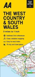 Road Map The West Country & South Wales(2022)Britain’s clearest mapping from the experts at the AA, in a handy foldable map. Fully updated, the map combines clear design and an easy-to-read scale with more road detail to ensure that you never lose your way.8,03 €
 -
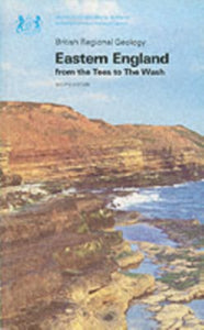 Eastern England from the Tees to the Wash(1981) KENT, P.E.,BRITISH GEOLOGICAL SURVEYRegional Geology Guides provide a broad view and interpretation of the geology of a region.10,81 €


-

Lifestyle torbe in nahrbtniki
Izberite torbo ali nahrbtnik, ki odraža vaš slog. Naša zbirka lifestyle torb...
-

Zvonci za kolo
Kolesarjenje je varnejše in zabavnejše z dobrim zvoncem. V naši zbirki najdete...
-

Bralne lučke
Poskrbite za pravo svetlobo pri branju z našo zbirko bralnih lučk. Kompaktne,...


