2633 rezultatov
-
 Running Is My Therapy(2019) DOUGLAS, SCOTTA lifelong runner’s groundbreaking guide to fighting depression and anxiety, one run at a timeVezava: Mehka18,21 €
 -
 South Devon & Dartmoor(2016) VICCARS, SUE8 circular walks complementing Pathfinder Dartmoor, exploring the hills, river valleys, coastline and picturesque villages of the South Hams and south-east Devon - including Princetown, Buckfastleigh Moor and Vixen Tor. Each walk has been tried and testedVezava: Mehka18,21 €
 -
 Pathfinder Wye Valley & Forest of Dean(2017) COATES, NEILRevised edition of Pathfinder(R) Guide Wye Valley and Forest of Dean, with 28 circular rambles of varying difficulty. Routes explore the middle and lower Wye, from Hay to Chepstow, across to the Brecon Beacons. All walks have GPS waypoints and Ordnance SuVezava: Mehka18,21 €
 -
 Brecon Beacons National Park / Parc Cenedlaethol Bannau Brycheiniog - Western Area / Ardal Gorllewinol(2015) ORDNANCE SURVEYOS Explorer is the Ordnance Survey's most detailed map and is recommended for anyone enjoying outdoor activities such as walking, horse riding and off-road cycling. The series provides complete GB coverage and can now be used in all weathers thanks to OS23,82 €
 -
 Kielder Water & Forest, Bellingham & Simonside Hills(2015) ORDNANCE SURVEYOS Explorer is the Ordnance Survey's most detailed map and is recommended for anyone enjoying outdoor activities such as walking, horse riding and off-road cycling. The series provides complete GB coverage and can now be used in all weathers thanks to OS23,82 €
 -
 Cotswolds, Burford, Chipping Campden, Cirencester & Stow-on-the Wold(2015) ORDNANCE SURVEYOS Explorer is the Ordnance Survey's most detailed map and is recommended for anyone enjoying outdoor activities such as walking, horse riding and off-road cycling. The series provides complete GB coverage and can now be used in all weathers thanks to OS23,82 €
 -
 Cairn Gorm & Aviemore, Loch Morlich(2015) ORDNANCE SURVEYOS Explorer is the Ordnance Survey's most detailed map and is recommended for anyone enjoying outdoor activities such as walking, horse riding and off-road cycling. The series provides complete GB coverage and can now be used in all weathers thanks to OS23,82 €
 -
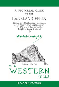 Western Fells (Readers Edition)(2016) WAINWRIGHT, ALFREDThe original Pictorial Guide to the Western Fells of Lakeland – freshly reproduced from Wainwright's original pages.Vezava: Mehka22,42 €


