2675 rezultatov
-
 Somerset & North Devon Coast(2019) KELSALL, DENNISThese attractive and cleverly structured guides will give walkers ten of the best short circular walks along each of the five sections of the 630-mile long South West Coast Path in a popular pocket-size format.Vezava: Mehka10,55 €
 -
 Walks with History(2019) KEW, FRANKThis attractive and cleverly structured guide gives walkers the ten best walks through the fascinating historic landscapes of the Yorkshire Dales National Park in a popular pocketable format.Vezava: Mehka10,55 €
 -
 Walks to Viewpoints (Top 10 Walks)(2018) DAKIN, CHIZThis attractive and cleverly structured guide gives walkers the ten best walks to the most stunning viewpoints in the Peak District National Park in a popular pocketable format.Vezava: Mehka10,55 €
 -
 Peak District (Top 10 walks)(2018) KELSALL, DENNISThis attractive and cleverly structured guide gives walkers ten of the finest short, circular, themed walks in the Peak District National Park in a popular pocketable format.Vezava: Mehka10,55 €
 -
 Jurassic Coast (Lyme Regis to Poole Harbour)(2018) KELSALL, DENNISThe ten best circular walks on the coast between Lyme Regis and Studland Bay. highlights include, Durdle Door, Lulworth Cove and Old Harry Rocks.Vezava: Mehka10,55 €
 -
 South Cornwall Coast(2019) KELSALL, DENNISWith clear information, an overview and introduction for each walk, expertly written numbered directions, large scale Ordnance Survey maps, superb eye-grabbing panoramic photographs, and interpretation of points of interest along the way, these guides setVezava: Mehka10,55 €
 -
 Llyn Peninsula Coast Path Map(2020)Enhanced, large scale (1: 25,000) Ordnance Survey mapping in a handy atlas format with all the mapping you need to walk the Llyn Peninsula section of the Wales Coast Path.Vezava: Mehka15,08 €
 -
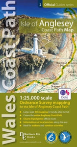
 Isle of Anglesey Coast Path Map(2019)Enhanced, large scale (1: 25,000) Ordnance Survey mapping in a handy atlas format with all the mapping you need to walk a complete circuit of the Anglesey section of the Wales Coast Path. Continuous OS mapping covering the complete circuit from Menai Brid15,08 €
 -
 Walks to Waterfalls(2012) COATES, NEILA guide that gives walkers ten of the finest walks to waterfalls in the Yorkshire Dales National Park in a popular pocketable format. It includes large scale Ordnance Survey maps, photographs, and interpretation of points of interest along the way.Vezava: Mehka10,55 €
 -
 Mountain Walks(2018) FERGUS, KEITHThe ten best circular walks in the Loch Lomond and The Trossachs Nationla Park. Classic summits include Ben Lond, Ben Vorlich, Ben Ledi and the Cobbler.Vezava: Mehka9,04 €
 -
 North Wales Coast Path Map(2022)One of seven handy, lightweight, pocket sized map bookscovering the whole of the 870 mile/1400 kilometre Wales Coast Path. This volume covers North Wales from Chester to Bangor and includes enhanced large scale (1:25,000) Ordnance Survey mapping in a hanVezava: Mehka15,08 €
 -
 South Devon Coast - Plymouth to Lyme Regis(2019) KELSALL, DENNISThese attractive and cleverly structured guides will give walkers ten of the best short circular walks along each of the five sections of the 630-mile long South West Coast Path in a popular pocket-size format.Vezava: Mehka10,55 €
 -
 Walking Cheshire's sandstone trail(2013) BOWERMAN, TONYA guide book to the Sandstone Trail that is suitable for weekend strollers and dedicated long-distance walkers alike. It features easy-to-follow route descriptions; detailed Ordnance Survey maps of the whole trail; explanations of the Trail's geology, hisVezava: Mehka19,60 €
 -
 Pembrokeshire North(2015) KELSALL, DENNISOne of the series of books in the new Top 10 Walks: Wales Coast Path series. Handy, pocket-sized, full colour walking guides written by experts. Each volume outlines the most popular circular walks along key sections of the coast path.Vezava: Mehka10,55 €
 -
 Pembrokeshire South(2015) KELSALL, DENNISOne of the series of books in the new Top 10 Walks: Wales Coast Path series. Handy, pocket-sized, full colour walking guides written by experts. Each volume outlines the most popular circular walks along key sections of the coast path.Vezava: Mehka10,55 €
 -
 Easy Walks from the Sandstone Trail(2016) BOWERMAN, TONYOne in the popular Top 10 Walks series of pocket-sized, full colour walking guides written by the author of the Official Guide to the Sandstone Trail. This attractive and cleverly structured guide gives walkers ten of the best new short circular walks froVezava: Mehka10,55 €
 -
 Woodland Walks(2013) CROW, VIVIENNEWith information, an overview and an introduction for each walk, this title contains expertly written numbered directions, large scale Ordnance Survey maps, panoramic photographs, and interpretation of points of interest along the way. It offers walkers tVezava: Mehka10,55 €
 -
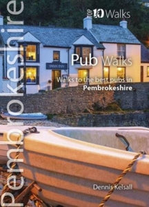
 Pub Walks Pembrokeshire(2017) KELSALL, DENNISThis attractive and cleverly structured guide gives walkers ten of the finest walks to the best pubs in the Pembrokeshire National Park in a popular pocketable format.Vezava: Mehka9,04 €
 -
 Carmarthen Bay & Gower(2013) ROBERTS, HARRIAn ntroduction for each walk, expertly written numbered directions, enhanced Ordnance Survey maps, superb, eye-grabbing panoramic photographs, and interpretation of points of interest along the way.Featured walks include: Pendine & Marros, Laugharne, LlanVezava: Mehka10,55 €
 -
 Tea Shop Walks(2018) CROW, VIVIENNEThese attractive and cleverly structured guidebooks give walkers the ten finest circular routes on a section of the Lake district National Park in a popular pocketable format.Vezava: Mehka10,55 €


