2675 rezultatov
-
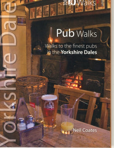
 Pub Walks(2012) CROW, VIVIENNEA guide that gives walkers ten of the finest walks to Lakeland pubs. With clear information, an overview and introduction for each walk, it offers expertly written numbered directions, large scale Ordnance Survey maps, panoramic photographs, and interpretVezava: Mehka10,55 €
 -
 Walks to Waterfalls(2012) CROW, VIVIENNEA guide that gives walkers ten of the finest walks to Lakeland waterfalls. Presented in a pocketable format, it includes waterfalls such as: Lodore Falls, Aira Force, Scale Force, Stock Ghyll, Skelwith Force, Colwith Force, Stanley Ghyll Force, Tom Gill,Vezava: Mehka10,55 €
 -
 Malvern Hills(2017)A Harvey superwalker covering whole of the ridge from North Malvern to Whiteleaved Oak, including the Herefordshire and Worcestershire Beacons.18,72 €
 -
 Trossachs North XT25(2022)More than a map - an essential piece of equipment. This new generation HARVEY Superwalker is designed to be the most practical tool for navigation outdoors.27,63 €
 -
 Pitlochry XT25(2021)Covers Pitlochry, Loch Tummel & Blair Atholl. Includes Ben Vrackie, one of the best viewpoints in the southern Highlands; Pass of Killercranckie and Aberfeldy. Lightweight, detailed, clear and easy to read. Printed on 100% waterproof, tearproof paper. GPS27,63 €
 -
 Munros, The Complete Collection of Maps(2019)This book provides a compendium of maps including coverage of every Munro (hill over 3000'). It will assist the planning of countless days of hillwalking. By its nature it is a picture of the upland topography of Scotland.Vezava: Trda62,37 €
 -
 Wicklow Mountains(2018)HARVEY Superwalker Wicklow Mountains map at 1:30,000 scale. Clear, easy to use, waterproof. GPS compatible.27,63 €
 -
 Knoydart(2021)This remote and beautiful area is often known as 'Scotland's last wilderness'. Detailed map for hillwalkers of Knoydart and Glen Shiel at the popular scale of 1:25,000.27,63 €
 -
 Frog Graham Round(2019)The Frog Graham Round is a swim and run challenge crossing 18 fell tops and 4 lakes in the Lake District. The route begins and ends in Keswick and covers a distance of approximately 64km (40 miles) with more than 15,000ft of ascent.27,63 €
 -
 Loch Lomond & The Trossachs(2019)The Ultramap covers a large area yet is small enough to slip in a pocket.It is a fully detailed genuine original HARVEY map. The Ultramap is tough, light and 100% waterproof.20,50 €
 -
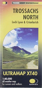 Trossachs North(2019)Covers a large area yet is handy and pocket perfect. 22 Munros, 14 Corbetts and 5 Grahams. Includes the iconic Ben Lui and the Cononish Gold Mine. All 7 Crianlarich Munros are on one side of the sheet.19,13 €
 -
Connemara(2019)HARVEY Superwalker map at 1:30,000 scale. Clear, easy to use, waterproof, GPS compatible. The most detailed map available of this area.27,63 €
-
 Pennine Way North(2019)The Pennine Way is a National Trail. It follows the backbone of England from the Peak District to the Scottish borders. It is one of the toughest UK long distance footpaths, and forms part of the European Footpath Network.31,19 €
 -
 Pennine Way South(2019)Now printed on 100% waterproof and practically indestructable polyethelene paper. Weighing half the weight of a laminated map this updated map from Edale to Middleton-in-Teesdale is the Southern part of the popular Pennine Way.31,19 €
 -
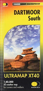 Dartmoor South(2020)The Ultramap covers a large area yet is small enough to slip in a pocket.It is a fully detailed genuine original HARVEY map. The Ultramap is tough, light and 100% waterproof.20,50 €
 -
 Coast to Coast(2021)NEW for 2021 - the whole of the Coast to Coast long distance walking route ON ONE MAP. The Coast to Coast is a 307km (192 miles) walking route across northern England, passing through the Lake District, Yorkshire Dales and North York Moors National Parks.31,19 €
 -
 Anglesey Coastal Path(2016)The 200km (125 mile) long Anglesey Coastal Path is a long distance route that follows much of the island's coastline and comprises one section of the Wales Coast Path. The path primarily caters for walkers however, cyclists and horse riders can also enjoy28,43 €
 -
 South West Coast Path 1(2018)NEW EDITION National Trail maps of the South West Coast Path. Whole route on 3 maps. Includes 2015 route changes. Genuine, original HARVEY mapping at 1:40000.28,43 €