139 rezultatov
-
 Navigational Instruments(2016) DUNN, RICHARD (ROYAL MUSEUMS GREENWICH, UK)With over two-thirds of the globe covered by water, the ability to navigate safely and quickly across the oceans has been crucial throughout human history. This book shows the solution of the infamous longitude problem, the impact of satellite positioningVezava: Mehka12,61 €
 -
 How to Read a Nautical Chart, 2nd Edition (Includes ALL of Chart #1)(2012) CALDER, NIGELProvides information on reading and relying on electronic and paper nautical charts. This title explains various aspects of electronic and paper nautical charts: how a chart is assembled, how to gauge the accuracy of chart data, how to read charts createdVezava: Mehka25,22 €
 -
 River Nene(2020) GREEN, ROGERWith support from the Inland Waterways Association, Friends of the River Nene and others, and drawing on his longstanding connection with the river, Roger Green has thoroughly revised and updated this popular guide.20,00 €
 -
 Imray Explorer Guide - Tides(2021) THOMSON, WILLIAMPart of an exciting new series of small format guides which help you better understand the sea, by William Thomson FRGS.Vezava: Mehka13,13 €
 -
 Inland Waterways of France Volume 2 Northeast and Southeast(2021) EDWARDS-MAY, DAVIDThe ninth edition of Inland Waterways of France is the ideal guide for planning cruises in and through the most fascinating and diverse waterway network in Europe. This edition takes a new paperback format, split into three volumes.Vezava: Mehka33,21 €
 -
 Shell Channel Pilot(2021) CUNLIFFE, TOMFor more than 80 years The Shell Channel Pilot has been the ultimate authority on English Channel navigation and pilotage.Vezava: Trda61,01 €
 -
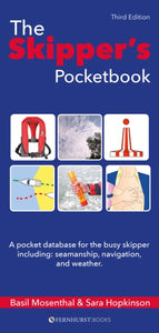 Skipper's Pocketbook(2018) MOSENTHAL, BASIL,HOPKINSON, SARAA pocket database of everything a busy skipper needs to know but might find hard to remember. It is designed as an aide-memoire with checklists to make life easier for busy skippers and a must-have reference for first-time skippers.Vezava: Mehka19,95 €
 -
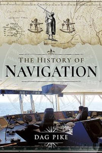 History of Navigation(2018) PIKE, DAGCovers marine and land navigational techniques from 3000 BC to the present day.Vezava: Trda35,05 €
 -
 Imray Chart E2(2024) IMRAY IOLAIREOn this edition the chart specification has been improved to show coloured light flashes. The harbour plans of Puerto de San Sebastian de la Gomera and Puerto de Naos & Los Marmoles (Marina Lanzarote) have both been extended to incorporate recent harbour36,99 €
 -
 Y17B(2024) IMRAY Y SERIESThis chart covers the Rivers Crouch & Roach and their approaches. It includes the latest official UKHO data, combined with additional information sourced from Imray's network to make it ideal for small craft. The chart has been fully revised throughout.36,30 €
 -
 Imray Chart Y12(2022) IMRAY Y SERIESFor this 2022 edition the chart has been fully updated throughout with revised depths and the latest harbour developments.27,73 €
 -
 Imray Chart Y2(2023) IMRAY Y SERIESFor this 2022 edition the chart has been fully updated throughout with revised depths.27,73 €
 -
 2000 Suffolk and Essex Chart Pack(2022) IMRAYA pack of 10 charts for the Suffolk and Essex Coasts. The latest depth surveys have been applied. The latest wind farm information is included where relevant. There has been general updating throughout.104,92 €
 -
 Imray Chart C28(2023) IMRAY C SERIESPlans included: Wells-next-the-Sea (1:30 000) Blakeney Harbour (1:28 000) Great Yarmouth Haven (1:10 000) Lowestoft Approaches (1:42 500) Southwold Harbour (1:12 500) Rivers Ore and Alde (1:42 500) River Deben (1:45 000) Lowestoft Harbour (1:12 000)44,71 €
 -
 Imray Chart B32(2022) IMRAY IOLAIREPlans included: Tyrrel Bay (Carriacou) (1:17 500) Grenada Bay (1:30 000) Grenville Harbour (1:15 000) Grenada - Southeast Coast (1:45 000) Grenada - South Coast (1:40 000) Saint George's Harbour (1:12 500)36,99 €