
1719 rezultatov
-
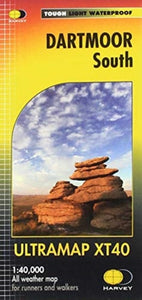 Dartmoor South(2020)The Ultramap covers a large area yet is small enough to slip in a pocket.It is a fully detailed genuine original HARVEY map. The Ultramap is tough, light and 100% waterproof.21,30 €
 -
 Pennine Way South(2019)Now printed on 100% waterproof and practically indestructable polyethelene paper. Weighing half the weight of a laminated map this updated map from Edale to Middleton-in-Teesdale is the Southern part of the popular Pennine Way.31,99 €
 -
 Pennine Way North(2019)The Pennine Way is a National Trail. It follows the backbone of England from the Peak District to the Scottish borders. It is one of the toughest UK long distance footpaths, and forms part of the European Footpath Network.31,99 €
 -
 Connemara(2019)HARVEY Superwalker map at 1:30,000 scale. Clear, easy to use, waterproof, GPS compatible. The most detailed map available of this area.28,43 €
 -
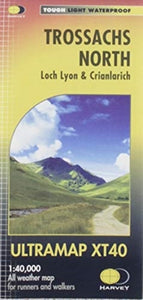 Trossachs North(2019)Covers a large area yet is handy and pocket perfect. 22 Munros, 14 Corbetts and 5 Grahams. Includes the iconic Ben Lui and the Cononish Gold Mine. All 7 Crianlarich Munros are on one side of the sheet.19,13 €
 -
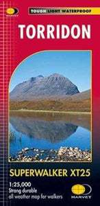 Torridon(2019)New Revised Edition and Format. More than a map, an essential piece of equipment this new generation HARVEY Superwalker is designed to be the most practical tool for navigation outdoors.28,43 €
 -
 South West Coast Path 1(2018)NEW EDITION National Trail maps of the South West Coast Path. Whole route on 3 maps. Includes 2015 route changes. Genuine, original HARVEY mapping at 1:40000.29,41 €
 -
 Anglesey Coastal Path(2016)The 200km (125 mile) long Anglesey Coastal Path is a long distance route that follows much of the island's coastline and comprises one section of the Wales Coast Path. The path primarily caters for walkers however, cyclists and horse riders can also enjoy29,41 €
 -
 Isle of Man(2016)Includes long distance routes, rights of way and Public Ramblage. Detailed map for hillwalkers at 1:30,000 scale covering the whole island on two sides of the sheet with a generous overlap.28,43 €
 -
 Lake District South East(2015)NEW!! Superwalker XT25 of the Lake District. Revised and re-designed. It's got everything! Genuine original HARVEY mapping at 1:25,000. Clear, easy to read. Easy to re-fold.28,43 €
 -
 Wilderness Trekking Oman - Map(2020) EDWARDS, JOHNThis map is a practical addition to the guide for hiking in the Western Hajar, which is the western portion of the main mountain range in the Sultanate of Oman.18,53 €
 -
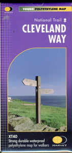 Cleveland Way(2020) HARVEY MAP SERVICES LTD.Cleveland Way National Trail was the second to be established in Britain and is now over 40 years old. Many walkers consider it to be a classic route because of the variety of landscapes through which it travels.29,41 €
 -
 Yorkshire Dales(2005)Walking map suitable for day visitors. Clear and easy to use. Extremely affordable price with useful information and contact details.12,39 €
 -
 Ben Nevis(2017) HARVEY MAP SERVICES LTD.Ben Nevis with the Mamores and Grey Corries ranges at 1:25,000 on a double-sided, waterproof and tear-resistant map from Harvey Map Services in their Superwalker series, with the peak area also shown in greater detail at 1:12,500.28,43 €
 -
 Lake District North(2021)New Superwalker XT25 of the Lake District. Revised and re-designed It's got everything! Genuine original HARVEY mapping at 1:25,000. Clear, easy to read. Easy to re-fold.16,58 €
 -
 Arran(2020) HARVEY MAP SERVICES LTD.More than a map,an essential piece of equipment. This new generation HARVEY Superwalker is designed to be the most practical tool for navigation outdoors.28,43 €
 -
 Cape Wrath Trail North(2019) HARVEY MAP SERVICES LTD.Cape Wrath Trail is a challenging route from Fort William to Cape Wrath. It is around 200 miles long and passes through some of Scotland's wildest and most spectacular scenery.31,99 €
 -
 Cape Wrath Trail South(2019) HARVEY MAP SERVICES LTD.Cape Wrath Trail is a challenging route from Fort William to Cape Wrath. It is around 200 miles long and passes through some of Scotland's wildest and most spectacular scenery.31,99 €
 -
 Rob Roy Way(2018) HARVEY MAP SERVICES LTD.Rob Roy Way is a walk across part of the Southern Highlands of Scotland taking in some of the most beautiful countryside in the UK. Starting from Drymen it goes north east to finish in Pitlochry.29,41 €


-

Lifestyle torbe in nahrbtniki
Izberite torbo ali nahrbtnik, ki odraža vaš slog. Naša zbirka lifestyle torb...
-

Zvonci za kolo
Kolesarjenje je varnejše in zabavnejše z dobrim zvoncem. V naši zbirki najdete...
-

Bralne lučke
Poskrbite za pravo svetlobo pri branju z našo zbirko bralnih lučk. Kompaktne,...


