1580 rezultatov
-
 Causeway Coast(2016)1: 25,000 scale Causeway Coast and Rathlin Island Activity Map - printed on water resistant paper - includes waymarked walks, surfing beaches, canoe trail access points, Giants Causeway World Heritage Site, Northwest 200 Motorcycle Road Race Route, and Ra18,28 €
 -
Londonderry(2018)The Discoverer series are designed for tourist and leisure activities. Each one covers an area of 40km x 30km at the scale 1:50,000. There are 93 sheet in the series. Discoverer Sheet No. 7 covers Londonderry and includes Limavady, Eglington and Dungive18,28 €
-
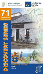 Kerry(2022)The Slieve Mish Mountains and the Stack's Mountains are two famous mountain ranges to be found on this map. The Stacks Mountains are, for the most part, covered in forestry. The Slieve Mish Mountains are more barren, with Baurtregaum and Caherconree being18,28 €
 -
 Crossway ESV Bible Atlas(2010) CURRID, JOHN D.,BARRETT, DAVID P.This groundbreaking, full-color companion to the ESV Bible combines visual appeal with state-of-the-art historical and geographical resources in one user-friendly volume.Vezava: Trda52,92 €