1615 rezultatov
-
 Haslemere & Petersfield, Midhurst & Selborne(2015) ORDNANCE SURVEYOS Explorer is the Ordnance Survey's most detailed map and is recommended for anyone enjoying outdoor activities like walking, horse riding and off-road cycling. Providing complete GB coverage the series details essential information such as youth hostels18,21 €
 -
 Dartmoor(2016) BROOKS, JOHN,CONDUIT, BRIAN28 circular, graded walks all tried and tested by seasoned walkers. The routes range from extended strolls to exhilarating hikes, so there is something for everyone.Vezava: Mehka18,21 €
 -
 North York Moors(2016) CONDUIT, BRIAN,KELSALL, DENNIS28 circular, graded walks all tried and tested by seasoned walkers. The routes range from extended strolls to exhilarating hikes, so there is something for everyone.Vezava: Mehka18,21 €
 -
 Snowdonia(2016) MARSH, TERRY20 circular walks in Snowdonia, all graded by route and difficulty, and now presented in an illustrated and easier-to-use layout, they can be enjoyed by the whole family and are the ideal companion for day trips and holidays.Vezava: Mehka11,20 €
 -
 Norfolk(2016) KELSALL, DENNISA revised Norfolk Pathfinder(R) Guide featuring 28 circular, graded walks all tried and tested by seasoned walkers, from the North Sea coastline to The Broads National Park. All routes are accompanied by GPS waypoints, Ordnance Survey maps and colour photVezava: Mehka18,21 €
 -
 Hertfordshire & Bedfordshire(2016) KING, DEBORAH28 circular, graded walks all tried and tested by seasoned walkers. The routes range from extended strolls to exhilarating hikes, so there is something for everyone.Vezava: Mehka18,21 €
 -
 New Forest, Hampshire & South Downs(2016) FOSTER, DAVID28 fabulous country walks focussing on the New Forest and South Downs National Parks, and the Itchen and Test valleys. Graded by length and ranging from 2 to 10 miles all routes come with a clear, large-scale OS map, GPS waypoints and highlight where to pVezava: Mehka18,21 €
 -
 South Pennines(2016) COATES, NEILA brand new title with 28 fabulous country walks in the southern Pennines, ranging from 3 to 10 miles with accompanying GPS references for all waypoints and clear, large scale Ordnance Survey route maps.Vezava: Mehka18,21 €
 -
 Thames Valley & Chilterns(2016) CHANNER, NICKA fully updated Pathfinder Guide to Thames Valley and the Chilterns, featuring 28 circular rambles across an area characterised by meadows and beech woods, visiting areas throughout Berks, Bucks and South Oxon. All walks are accompanied by GPS waypoints,Vezava: Mehka18,21 €
 -
 Adventure Map of Ireland(2021)Ireland's beautiful landscape offers so much potential for adventure whether on foot, bike or boat. This unique map documents thousands of the island's natural features such as rivers, beaches and mountains as well as the walking, cycling and paddling rou23,17 €
 -
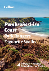 Pembrokeshire Coast Park Rangers Favourite Walks(2022) NATIONAL PARKS UKThe perfect companions for exploring the National Parks. Walking guide to the Pembrokeshire Coast National Park, with 20 best routes chosen by the park rangers. Each walk varies in length from 2 to 10 km and can be completed in less than 4 houVezava: Mehka11,63 €
 -
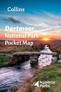 Dartmoor National Park Pocket Map(2021) NATIONAL PARKS UK,COLLINS MAPSHandy little full-colour map and guide of Dartmoor National Park.5,60 €


