


1565 rezultatov
-
 Forest of Bowland & Ribblesdale, Pendle Hill, Clitheroe & Settle(2015) ORDNANCE SURVEYOS Explorer is the Ordnance Survey's most detailed map and is recommended for anyone enjoying outdoor activities like walking, horse riding and off-road cycling. Providing complete GB coverage the series details essential information such as youth hostels18,21 €
 -
 Torquay & Dawlish, Newton Abbot(2015) ORDNANCE SURVEYOS Explorer is the Ordnance Survey's most detailed map and is recommended for anyone enjoying outdoor activities like walking, horse riding and off-road cycling. Providing complete GB coverage the series details essential information such as youth hostels18,21 €
 -
 Kielder Water & Forest, Bellingham & Simonside Hills(2015) ORDNANCE SURVEYOS Explorer is the Ordnance Survey's most detailed map and is recommended for anyone enjoying outdoor activities like walking, horse riding and off-road cycling. Providing complete GB coverage the series details essential information such as youth hostels18,21 €
 -
 North York Moors - Western Area(2015) ORDNANCE SURVEYOS Explorer is the Ordnance Survey's most detailed map and is recommended for anyone enjoying outdoor activities like walking, horse riding and off-road cycling. Providing complete GB coverage the series details essential information such as youth hostels18,21 €
 -
 Winchester, New Alresford & East Meon(2015) ORDNANCE SURVEYOS Explorer is the Ordnance Survey's most detailed map and is recommended for anyone enjoying outdoor activities like walking, horse riding and off-road cycling. Providing complete GB coverage the series details essential information such as youth hostels18,21 €
 -
 North Pennines - Teesdale & Weardale(2015) ORDNANCE SURVEYOS Explorer is the Ordnance Survey's most detailed map and is recommended for anyone enjoying outdoor activities like walking, horse riding and off-road cycling. Providing complete GB coverage the series details essential information such as youth hostels18,21 €
 -
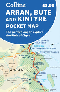 Arran, Bute and Kintyre Pocket Map(2022) COLLINS MAPSHandy little full colour map of Arran, Bute and Kintyre.6,64 €
 -
 South West England's Coast(2019) VICCARS, SUENew Pathfinder (R) walking guide to South West England featuring 30 circular walks ranging in length from 2 to 13 miles. Exploring the UK's most popular National Trail, the South West Coast Path, all walks are accompanied by GPS waypoints, Ordnance SurveyVezava: Mehka18,21 €


