2173 rezultatov
-
 Spanish Trails - A Guide to Walking the Spanish Mountains(2017) LAWLER, PHILn this book Phil Lawler offers a wide selection of walks across the Picos de Europa in the majestic Cordillera Cantabrica, the Cantabrian Mountains, which run parallel with the Atlantic coastline in northern SpainVezava: Mehka23,15 €
 -
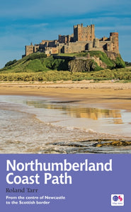 Northumberland Coast Path(2016) TARR, ROLANDThe Northumberland coastline stretches from the outskirts of Newcastle up to the Scottish border at Berwick-upon-Tweed.Vezava: Mehka21,02 €
 -
 South West Coast Path: Padstow to Falmouth(2018) MACADAM, JOHNThe official guide to the Padstow to Falmouth section of Britain’s longest National Trail, published in association with Walk Unlimited.Vezava: Mehka21,02 €
 -
 Cotswold Way(2016) BURTON, ANTHONYFollowing the limestone escarpment on the Western edge of the Cotswolds, the 102 miles of the Cotswold Way take the walker through a quintessentially English landscape as varied as it is beautiful.Vezava: Mehka21,02 €
 -
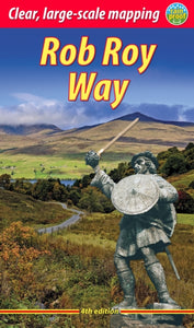 Rob Roy Way (4 ed)(2024) MEGARRY, JACQUETTARevised 4th edition of guidebook for a trail linked with Scotland's most famous outlaw, Rob Roy MacGregor. It runs from Drymen to Pitlochry, with superb Highland scenery, wildlife, history and heritage. Based on fieldwork in 2021, here is how to plan andVezava: Mehka24,70 €
 -
 100 Walks in Lancashire(2015) CLARE, BOBLancashire is a walker's paradise with many unexpected delights such as Silverdale and the Forest of Bowland. This collection of 100 great walks will help you explore the diverse and beautiful landscapes of this fascinating yet under-rated county.Vezava: Mehka20,07 €
 -
 Kerry Walks(2016) CORCORAN, KEVIN20 accessible walks covering Kerry's spectacular scenery. Walks around Kenmare, Killarney, Dingle, Iveragh Peninsula and North Kerry. Illustrated with the author's drawings. Completely updated and revised.Vezava: Mehka12,82 €
 -
 Notting Hill(2018) MASH, JULIANA walking guide to this historic London neighbourhood, uncovering its countercultural roots.Vezava: Trda20,86 €
 -
 Cairngorms North(2021) FERGUS, KEITHA detailed and superbly illustrated guidebook to walking the high tops, foothills, forests and glens of the Northern CairngormsVezava: Mehka23,09 €
 -
 Norfolk Year Round Walks(2019) LOWEN, JAMESThese 20 circular walks, varying in length from 2 to 7 miles, take in renowned beauty spots, hidden gems and must-sees from across Norfolk. Includes coast and Broads. Walks for spring, summer, autumn and winter.Vezava: Mehka15,43 €
 -
 Guide to Suffolk Pub Walks(2017) PAGE, LAURIEDiscover the beauty of Suffolk with this guide to some of the best walks the county has to offer. The idyllic countryside of the Stour Valley, the thatch cottages and the fine churches of chocolate-box villages are all included. Walkers can also explore tVezava: Mehka10,80 €
 -
 Day Walks on the Pembrokeshire Coast(2018) ROBERTS, HARRIDay Walks on the Pembrokeshire Coast by Harri Roberts features 20 coastal routes suitable for hillwalkers of all abilities. Together with stunning photography, each route features Ordnance Survey 1:25,000 maps, easy-to-follow directions, distance and naviVezava: Mehka23,09 €